The Genesee Valley Canal was hand-dug with its planning starting around 1832. It offered a north-to-south route that complemented the east-to-west Erie Canal route. It became important as Rochester’s energy needs grew for heating, milling, manufacturing and illumination. The Genesee Valley Canal could access the emerging Pennsylvania energy resources of coal and crude oil. The Vacuum Oil refinery used the canal to access crude oil by boat initially and later by the railroad that used the former canal bed. Railroads could bring coal to the energy storage hub at today’s Nick Tahou / Canal Street coal storage assets where the GVC originated.
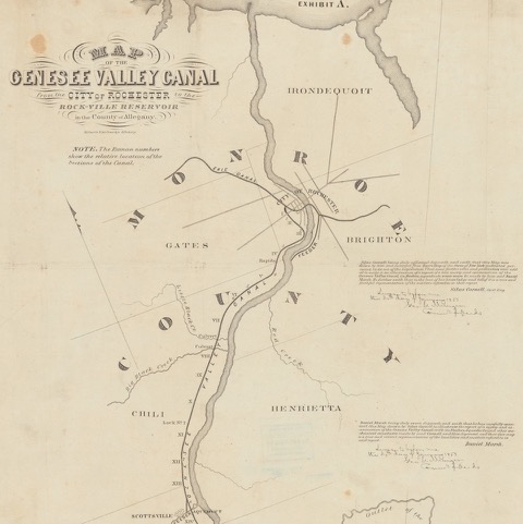
1855 Genesee Valley Canal map including the Erie Canal and Feeder Canal routes in Monroe County. It led to Pennsylvania.
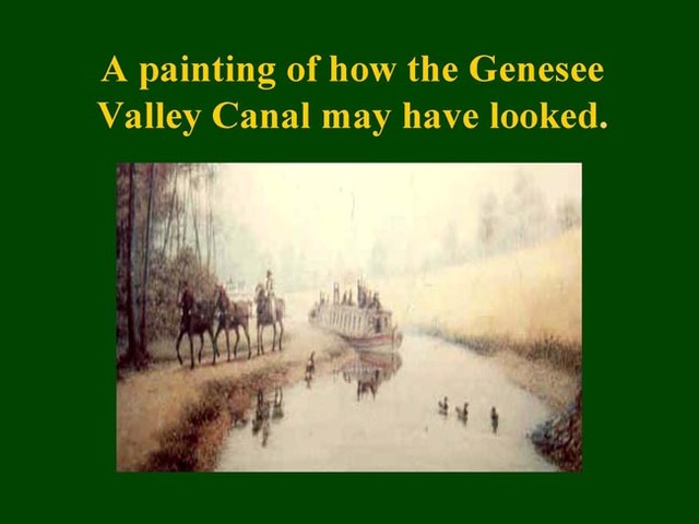
A typical horse-drawn canal boat with passengers on the upper deck. (Courtesy: Friends of the Genesee Valley Canal)
The light blue line shows the first three miles of the Genesee Valley Canal in this adapted1838 map.
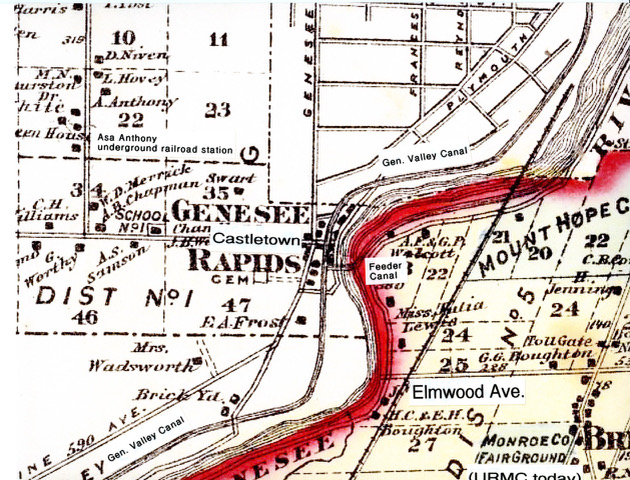
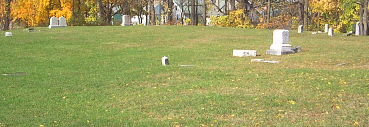
The Genesee Valley Canal was the prominent developed feature of the Rapids settlement starting in 1837.
Many Rapids settlers had work-related lies to the GVC which declined steadily before 1878.
GVC pavement commemoration at Brooks Landing marking the width of the canal at the hotel parking lot.
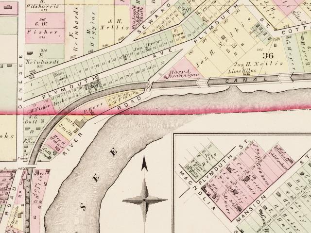
Genesee Valley Canal passing through today’s Brooks and Plymouth Avenues with lock locations.
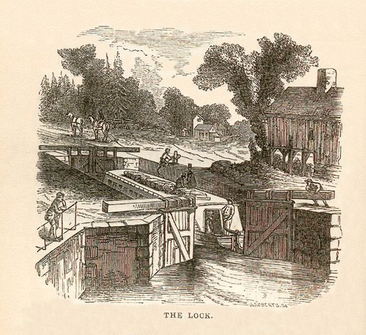
Typical lock system and construction of the Genesee Valley Canal. Most of the canal distance had walls of pressed earth.
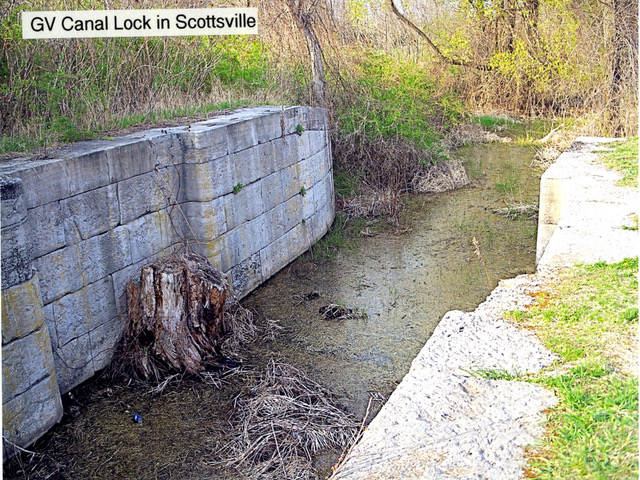
This remnant of a Genesee Valley Canal lock is about two miles south of Brooks Landing. Note its narrow width.
2011 image showing the visible bare earth curved route of the Genesee Valley Canal proceeding northward.
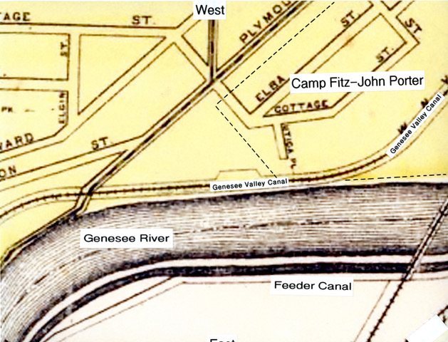
The Genesee Valley Canal (later a railroad) heads to the location of Camp Fitz-John Porter.
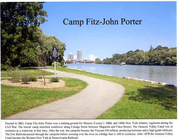
Camp Fitz-John Porter memorial site along the Genesee River at Flint Street with Rochester skyline in the background.
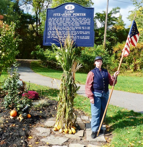
Memorial plaque at Camp Fitz-John Porter location with the Genesee Valley Canal route in the background.
Crude oil arrived on barges in 1866 until the canal was replaced by a railroad.
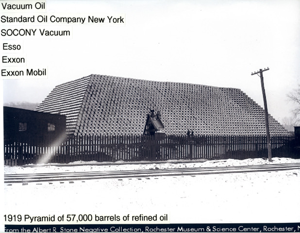
Vacuum Oil was a predecessor to today’s Exxon-Mobil. It ceased operation in the 1930s.
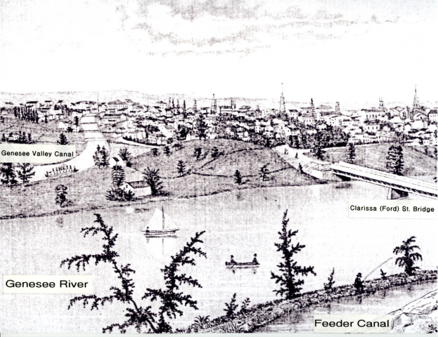
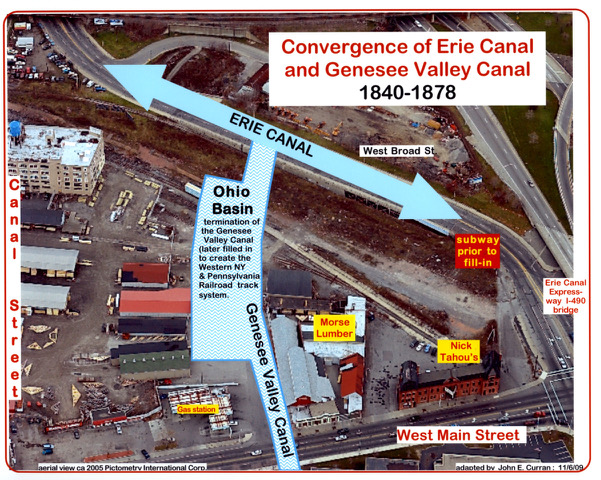
The Genesee Valley Canal diverted westward heading to Canal Street.
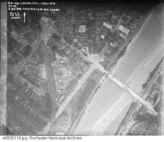
1918 aerial photo of the discontinued canal serving as a railroad route near the Clarissa (Ford) Street Bridge.
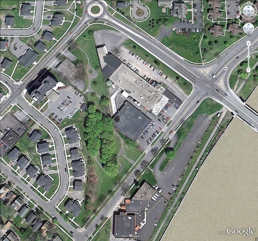
The Genesee Valley Canal’s prism-base is still evident in the green corridor leading to Ford Street.

1918 aerial photo shows Mile One of the GVC route as it approached West Main Street and the Erie Canal.
This 2006 adapted aerial photo shows the beginning of the Genesee Valley Canal which is now completely filled-in.
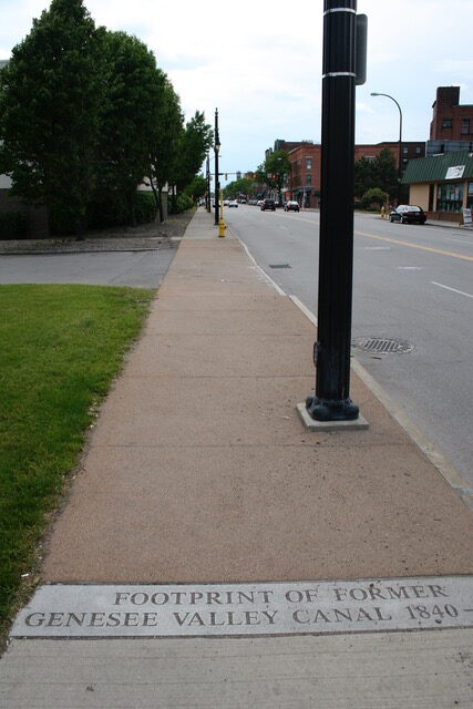
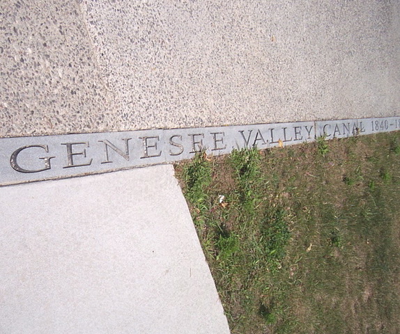
West Main and Canal Streets inscription marking the Genesee Valley Canal’s 1840-1878 years of operation.
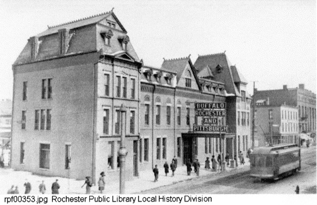
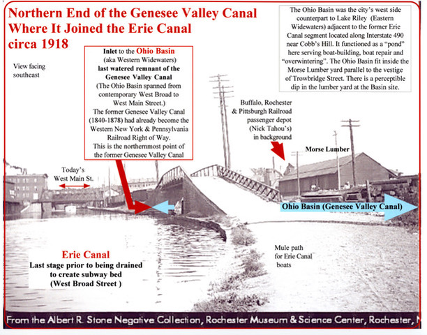
The GV Canal joined with the Erie Canal next to the Buffalo, Rochester & Pittsburgh RR station (today’s Nick Tahou’s).
After 1923, the former Erie Canal bed became the rail surface for the subway system serving Rochester.
Convergence of the Erie Canal and the starting point of the Genesee Valley Canal just north of West Main Street.