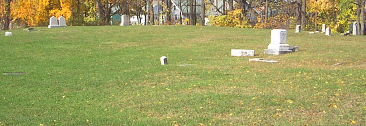
Barely noticeable and endangered today is the remnant of the Feeder Canal. It played a major role in the preeminence of Rochesterville during the early days of the Erie Canal. The “Flour City” era of the city of Rochester depended on the supply of wheat transported to the downtown water-powered mills. River water “fed” from the higher elevation near today’s Brooks Landing assisted the flow of the Erie Canal downtown. The Feeder Canal contributed to the decline of the pioneer Rapids settlement.
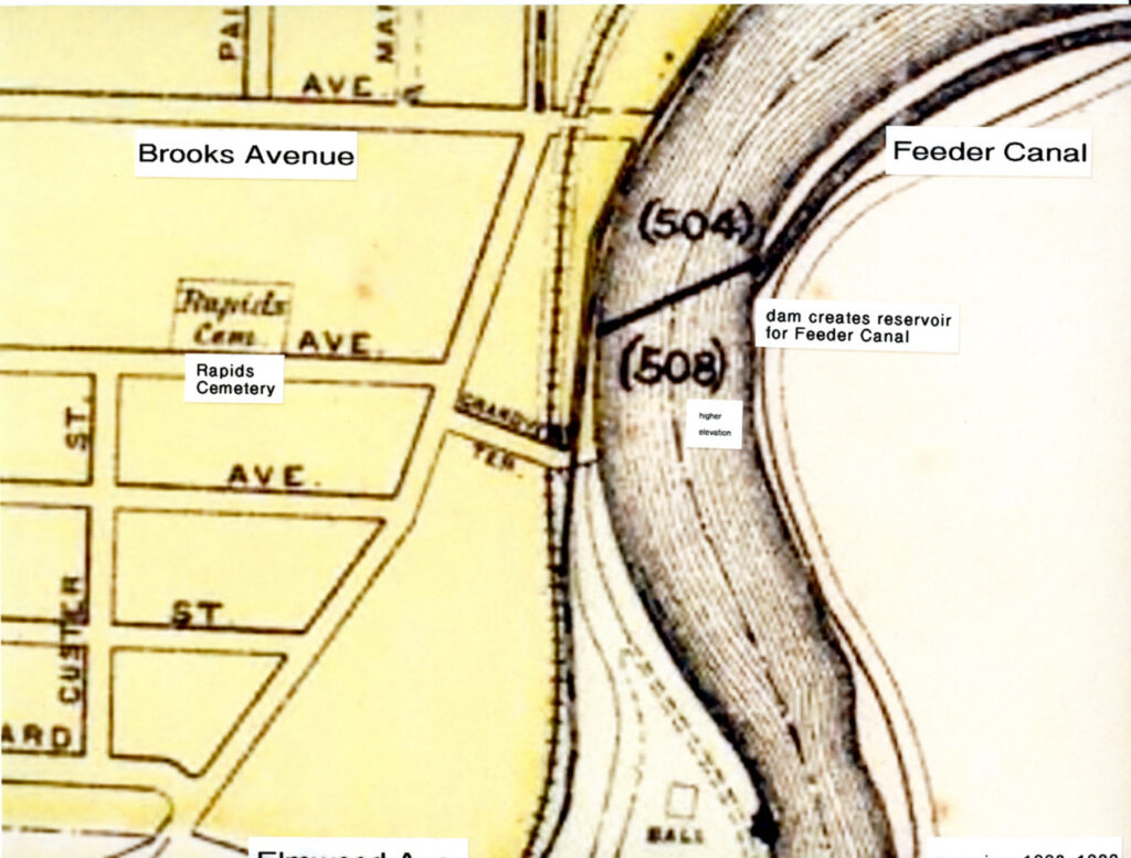
The Feeder Canal at Brooks Landing takes advantage of a sea level change that moves river-supplied water northward.
Water “fed” from the Genesee River flowed downtown to refresh the Erie Canal water supply until its relocation in the 1920s.
This photo circa 1903 shows the simplicity of the Feeder Canal. It was created from pressed earth with no stone walls.
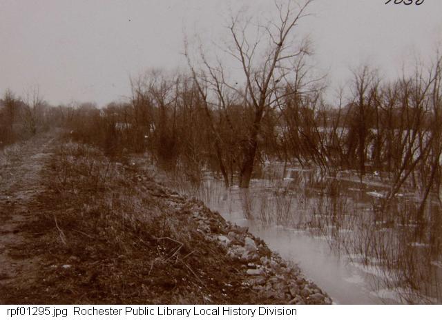
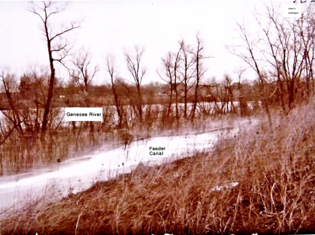
Facing south around 1903 under apparent flooding conditions. Feeder Road later became Wilson Boulevard.
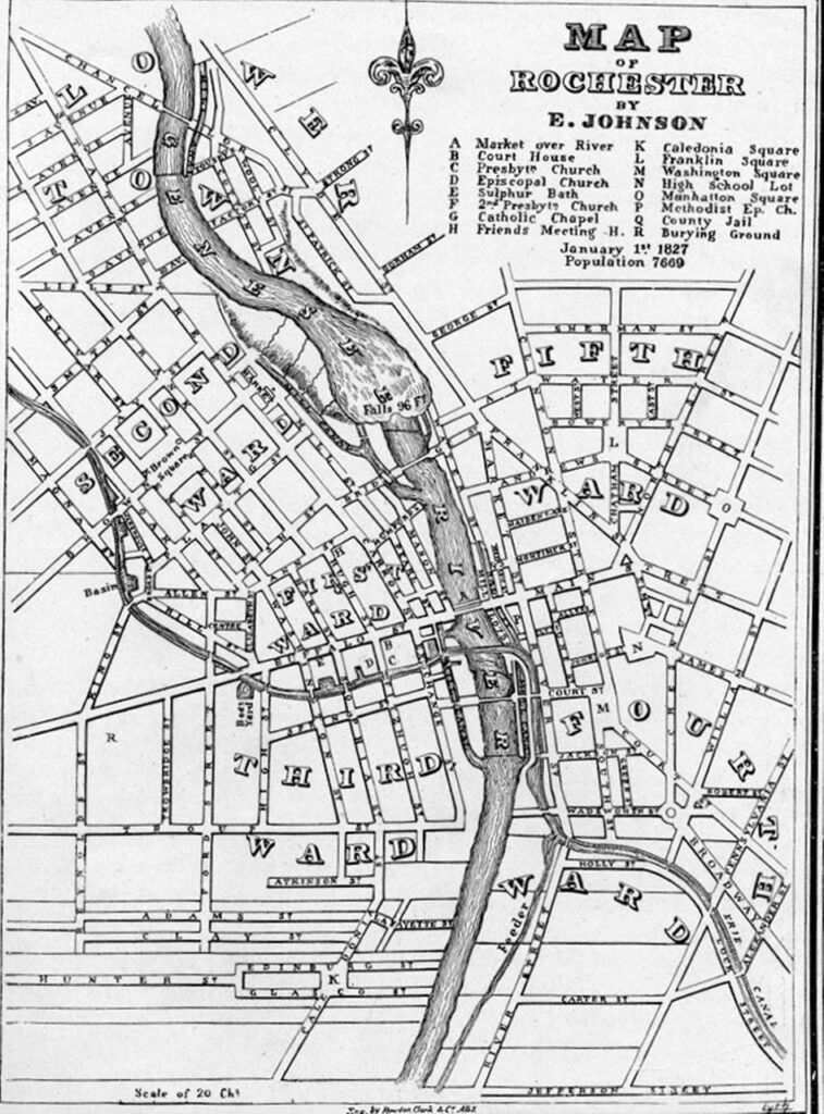
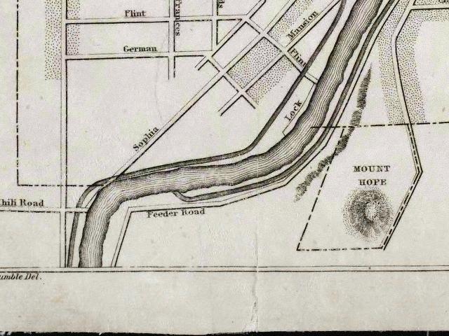
The Feeder Canal starts at today’s UR River Campus. This map shows the Erie Canal at upper left.
Replica Durham Boat propelled by men using poles carried products along the Feeder Canal during the “Flour City” phase.
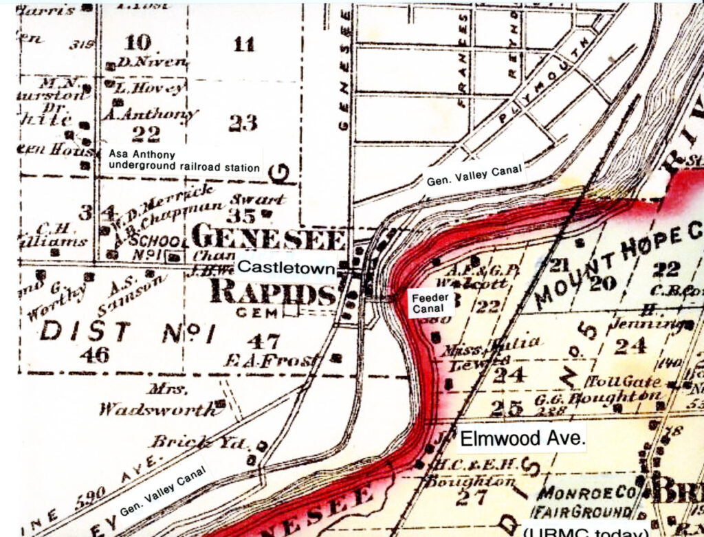
The Genesee Valley Canal route on the west side paralleled the Feeder Canal at the Rapids settlement.
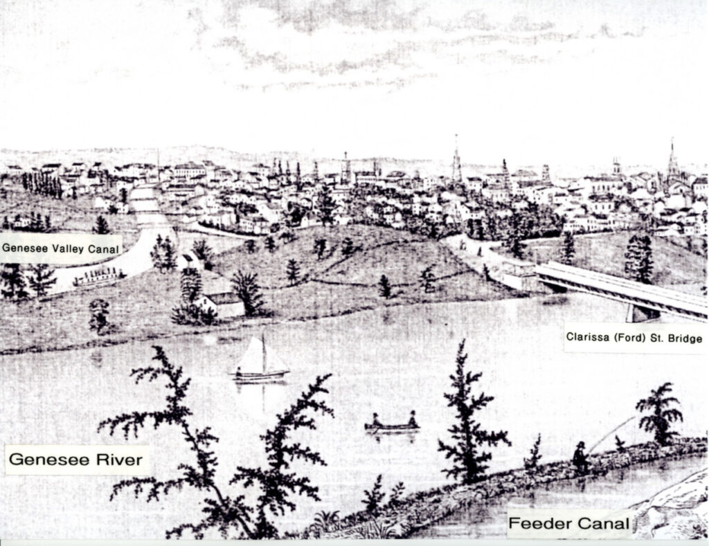
The Genesee Valley Canal on the west bank heads westward to Canal Street. The Feeder Canal proceeds to the Erie Canal.
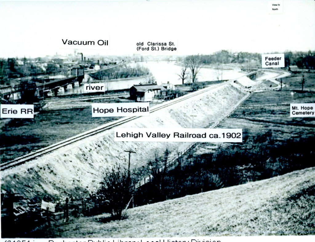
Feeder Canal near the west side Vacuum Oil refinery. Hope Hospital was an infectious disease ward.
1984 photo reveals strip between the trees where the railroad followed the Feeder Canal route at the Hope Hospital site.
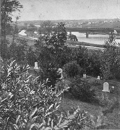
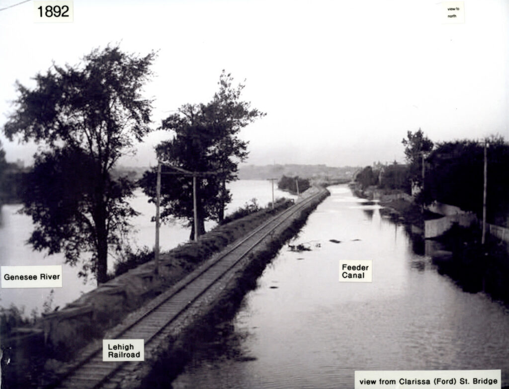
A strip of land separates the Feeder Canal from the Genesee River in this 1854 photo taken from Mt. Hope Cemetery.
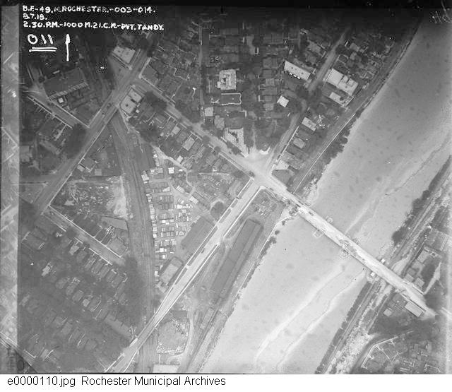
1918 Clarissa bridge photo shows the abandoned Genesee Valley Canal on the west and the old Feeder Canal on the east.
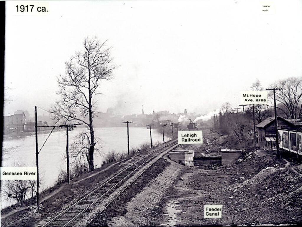
View north from the Clarissa bridge. The Feeder Canal’s transportation role faded as rail service increased.
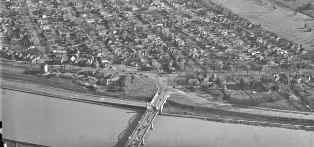
Same location north of the Clarissa (Ford) Street Bridge with the Feeder Canal drained after disuse.
1930s photo shows the railroad using the former Feeder Canal route. Ellwanger nurseries begin to transform as Highland Park.
Former Troup-Howell Bridge. Abandoned railroad depot assets here were converted to public housing projects after the 1970s.
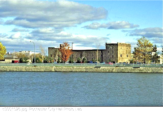
The stone warehouse at Mt. Hope Avenue dates back to the early 1820s when the Erie Canal was built.
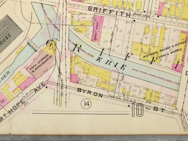
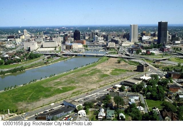
Image #18: This map shows where the Feeder Canal converged with the Erie Canal south of Court Street.
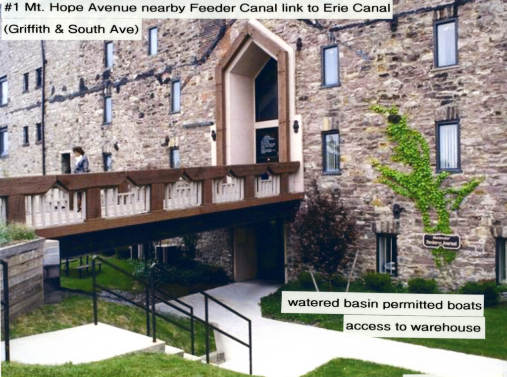
This 2007 photo shows the west side of the warehouse which had a basin permitting deliveries by boat.
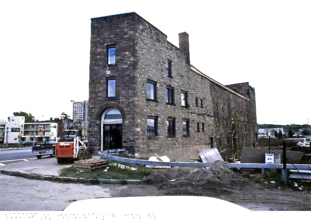
Image #20: Stone warehouse (circa 2004 photo) near the spot where the Feeder Canal linked with the Erie Canal.
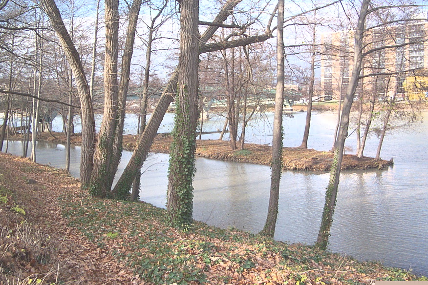
Last watered portion of the Feeder Canal at the UR River Campus next to the pedestrian bridge 2018.
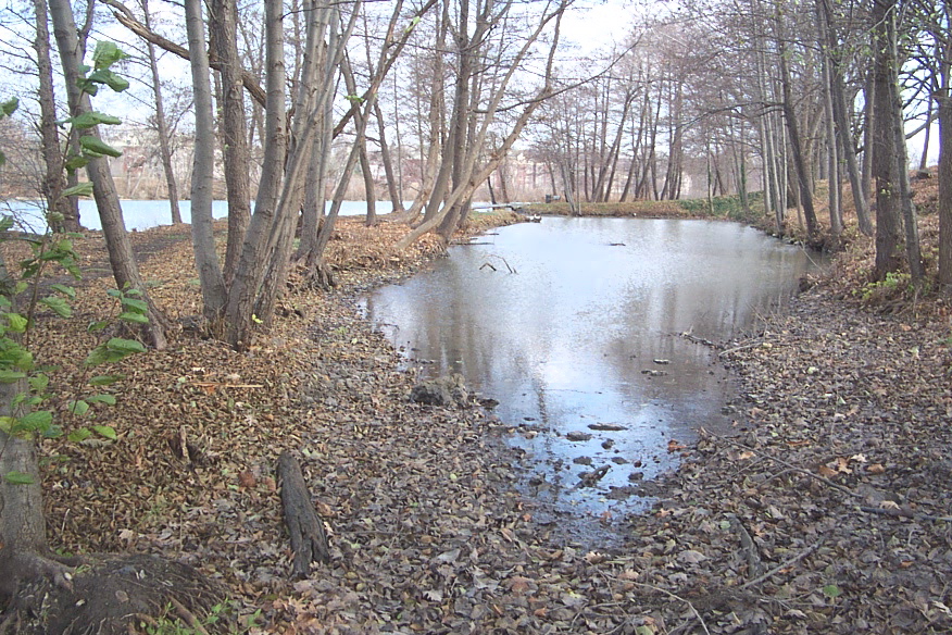
Dwindling remnant of the Feeder Canal at Wilson Boulevard facing north.
Last endangered vestige of the Feeder Canal in 2018. View from the Brooks Landing pedestrian bridge at the River Campus.